2023 Vol. 43, No. 3

Research and Agency Updates
An Analytical Interpretation of NASA's FY 2024 Budget in Space Science and Technology
WANG Haiming, YANG Fan
2023, 43(3): 381-388. doi: 10.11728/cjss2023.03.yg05
Abstract:
NASA's Fiscal Year (FY) 2024 budget request, released in March 2023, was analyzed and discussed in the present work. An overview of NASA's FY 2024 budget and its funding priorities in the areas of Deep Space Exploration Systems, Space Operations, Space Technology, and Science were provided. Key issues including the positive response of NASA's FY 2024 budget to NASA Strategic Plan 2022, the potential impact of the budget requests on NASA's research portfolio, the severe inflationary situation in the US, and the potential impact of budget uncertainty on NASA's future development were examined and discussed.
Suggestions on Scientific Objectives of Deep-space Satellite Constellation to Explore the Sun and Inner-heliosphere from an Unprecedented Stereoscopic Panorama Viewpoint
XIONG Ming, FENG Xueshang, XIA Lidong, HUANG Zhenghua, LI Bo, GAO Yanchen, LIU Weixin, SUN Mingzhe, ZHANG Hongxin, DAI Shuwu, WANG Ying
2023, 43(3): 389-405. doi: 10.11728/cjss2023.03.210728081
Abstract:
To meet the national strategic demands in understanding solar storms and safeguarding deep-space exploration, several solar and interplanetary mission concepts have been recently proposed in China. These mission concepts include one Sun-orbiting Lagrangian L3-L4-L5 satellite constellation in the ecliptic and twin Sun-orbiting polar satellites out of the ecliptic, aiming at an unprecedented stereoscopic view of the Sun and the inner heliosphere. For the joint multi-constellation mission, its scientific objects can be defined as solar magnetic field, solar storm, and solar wind, with its application object identified as space weather prediction. Each satellite is suggested to carry a suit of scientific instruments to measure photon emissions, particle radiation, and electromagnetic waves. Using the three-dimensional numerical magnetohydrodynamic simulation of solar-terrestrial space and the aesthetic visualization of computer graphic design, the exploration scenario of the in-ecliptic Sun-staring satellites and the out-of-ecliptic bird-view satellites is vividly presented. The potential multi-constellation mission in China is expected to be able to uncover the mysterious origin and eruption of solar magnetic field, understand the space weather chain of Sun-Earth coupling system, and provide the initial and boundary conditions for three-dimensional data-driven space weather modelling. Therefore, if being carried out successfully, such a multi-constellation mission can be a historic landmark in improving the performance of space weather monitoring, research, and service in China.
Current Status and Future Perspectives of Solar Spectroscopic Observations at Extreme Ultraviolet Wavelengths
BAI Xianyong, TIAN Hui, DENG Yuanyong, CHEN Yajie, HOU Zhenyong, YANG Zihao, ZHANG Zhiyong, DUAN Wei, LI Wenxian, GUO Sifan
2023, 43(3): 406-422. doi: 10.11728/cjss2023.03.220125010
Abstract:
More than 70 years of the space-borne solar exploration clearly shows that Extreme Ultraviolet (EUV) wavelengths are very useful for observations of the solar transition region and corona. Because of this, almost all of the current and future solar space missions have EUV payloads. Unfortunately, China has never sent a solar EUV spectrometer to space so far, which significantly restricts the chance for Chinese solar physicists to have original discoveries and breakthroughs. Now it is the right time to develop our own payloads and contribute to space exploration of solar physics. In the paper, the characteristics of solar irradiance as well as the common optical elements at EUV wavelengths are introduced firstly. The history, current status and future perspectives of solar EUV spectroscopic observations are systematically reviewed, including the instrument designs and major scientific achievements. Three major types of spectroscopic observations are focused on, i.e., full-disk integrated irradiance measurements, low-speed spectroscopic imaging observations with a certain spatial resolution and two-dimensional fast spectroscopic imaging. Then, a three-step development strategy is proposed to start Chinese solar EUV spectroscopic observations in space. The scientific objectives, observational requirements and candidate schemes of each step are discussed. Moreover, a solar EUV imager working at a wavelength that has never been done before is suggested. Once the above explorations are successfully implemented, major advances towards our understanding of many unsolved solar mysteries will be made, including the accurate speed estimation of coronal mass ejections and forecast of their arrival times at the Earth, the origin of solar wind and coronal heating mechanism, as well as the generation mechanism of solar eruptions. It will significantly elevate the level of key technologies involved in ultraviolet space explorations, too.
Modeling of Auroral Electrojet Index with Ultraviolet Aurora Image
XIAO Hui, TIAN Xinqin
2023, 43(3): 434-445. doi: 10.11728/cjss2023.03.2022-0033
Abstract:
The auroral electrojet index AE is an important indicator to describe the intensity of geomagnetic substorms, and is closely related to the polar magnetosphere disturbance and the precipitation process of auroral particles. Therefore, it is of great significance to establish an accurate prediction model of the electrojet index for the study of space weather. In this paper, the correlation of the spatial distribution of aurora power IAP and AE index in different seasons are studied by using the ultraviolet aurora image data of Polar satellite in 1997, and on this basis, a prediction model of AE index based on the ultraviolet aurora image is proposed. The grid method is used to extract the spatial distribution characteristics of the aurora intensity of the ultraviolet aurora image. The generalized regression neural network GRNN is used to construct two AE index models, Cor-GRNN model and Var-GRNN model, by using the correlation coefficient method and variance selection method, and training is conducted for the three seasons. The results show that AE and IAP have a similar semi-annual change trend, and their correlation varies greatly in different seasons. Compared with the AE index neural network prediction model driven by the solar wind, the model based on aurora images is superior to other models in terms of ERMS and R2 standards. The normalized ERMS is less than 0.1, and the model’s interpretability for AE index changes is increased by about 10%.
Evolution of Equatorial Plasma Bubbles Group Simultaneously Observed by Multi-instruments over China
WU Kun, XU Jiyao, YUAN Wei
2023, 43(3): 446-455. doi: 10.11728/cjss2023.03.2022-0030
Abstract:
The Equatorial Plasma Bubbles (EPB) of 30 March 2014 were studied using airglow images of 630 nm emission from all-sky imager and observations of Viral Hemorrhagic Fever (VHF) radar over Hainan Fuke Station (19.5°N, 109.1°E) from the Chinese Meridian Project, digisonde over Hainan Sanya Station (18.4°N, 109.6°E), and data of the Communication/Navigation Outage Forecasting System (C/NOFS). In this case, the morphological features and evolution processes of these EPBs were analyzed and studied in detail. The results showed that there was a group of EPB over China during the night of 30 March 2014. The EPB group includes about nine EPB which were simultaneously observed by multi-instrument. These EPBs occurred after sunset, lasting after midnight. The lifetime of the EPBs is about eight hours (from 20:15 LT to 04:15 LT). These EPB moved from west to east during the night. The maximal scale of their longitudinal ranges is more than 1200 km. East-west ranges of the EPB group are more than 1400 km. Besides, two EPBs showed a merging process in the evolutionary process. Portion of b6 merged into the other EPB and then formed into one EPB. When these EPBs were observed by the all-sky imager, the corresponding range spread F and plume irregularities were also simultaneously observed by the digisonde and VHF radar, respectively. Meanwhile, observations from C/NOFS also showed plasma depletion over the same period. Evolutions of these EPBs were simultaneously observed by optical equipment (all-sky imager) and radio equipment (VHF radar and digisonde) of ground-based measurements, and C/NOFS satellite. The observation results show that evolution of these EPBs which is simultaneously observed by multi-instrument. These observation results and the study enrich research of ionospheric irregularity based on observations of multi-instrument.
Construction and Verification of DAM Model
LIU Wei, LUO Bingxian, GONG Jiancun, HE Quan, WANG Ronglan, XIANG Kaiheng
2023, 43(3): 475-484. doi: 10.11728/cjss2023.03.2023-0007
Abstract:
The physical model of the thermosphere and the empirical and semi-empirical model of the thermosphere are analyzed. The basic theory and code analysis of the empirical thermosphere model are used to clarify the model construction methods. Based on the current situation of atmospheric modeling in China, the difficulties are analyzed and development suggestions are given. Based on the GOST model, the prediction performance of atmospheric model in geomagnetic disturbed period was analyzed, and the construction of atmospheric model in geomagnetic storm period was studied. The Disturbed Atmospheric Model (DAM) was constructed based on the measured density data, and its validity was verified. It is found that the mean relative errors of GOST, MSIS00 and DAM models are 64.32%, –176.72% and –14.83%, respectively, within the range of geomagnetic index Ap 100~132. As Ap is within the range of 80~132, the relative error mean of each model is 77.44%, –136.74%, –14.14% respectively, DAM model is significantly improved compared with GOST and MSIS00. It is proved that the modeling method of estimating model parameters by building an atmospheric model framework and measured density data is feasible and effective.
Design and Verification of Scientific Exploration Mode of Zhurong Mars Rover
WANG Lianguo, ZHU Yan, ZHANG Baoming, SHEN Weihua, LI Xue, XUE Bin, LI Yuxi, XU Weiming, SUN Shuquan, CAI Zhiguo, WANG Wei
2023, 43(3): 485-498. doi: 10.11728/cjss2023.03.20220022
Abstract:
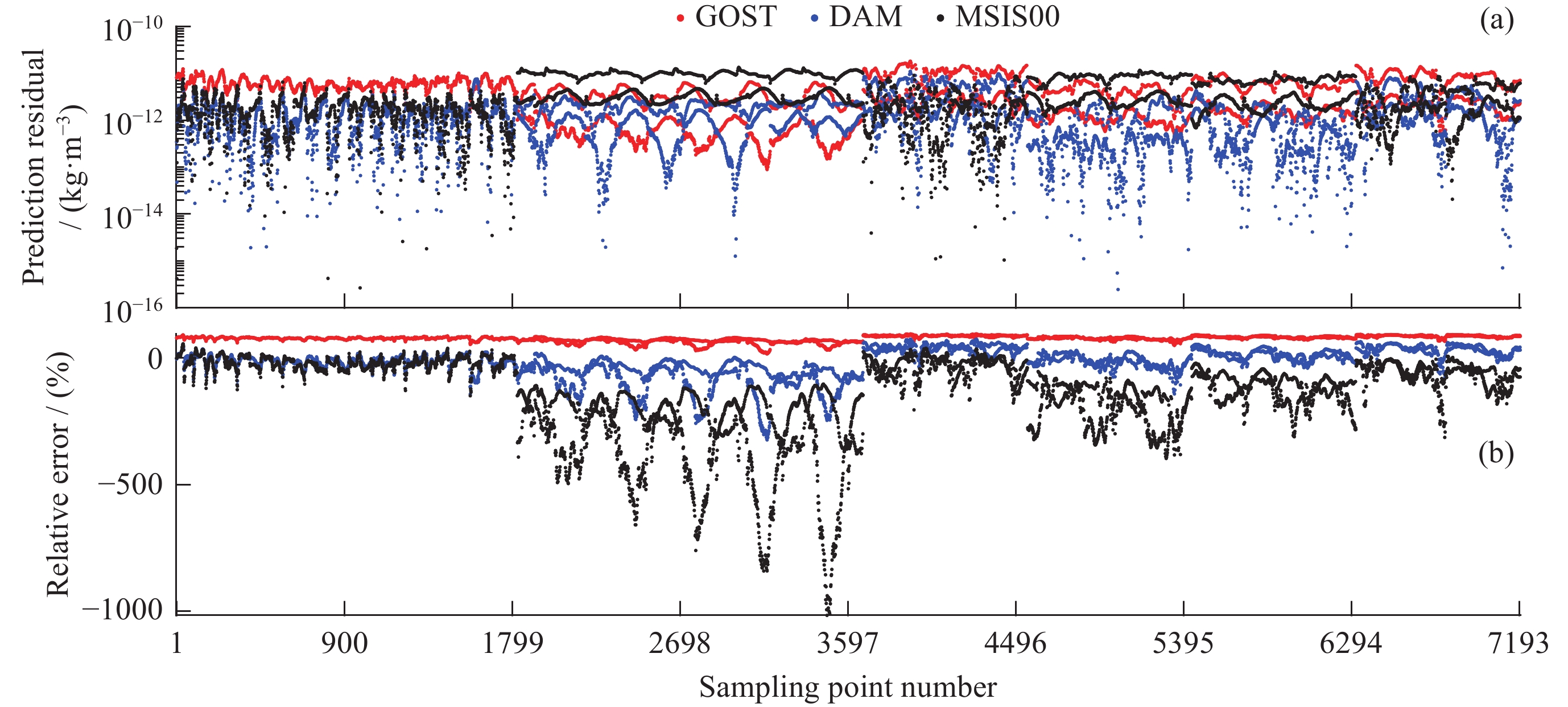
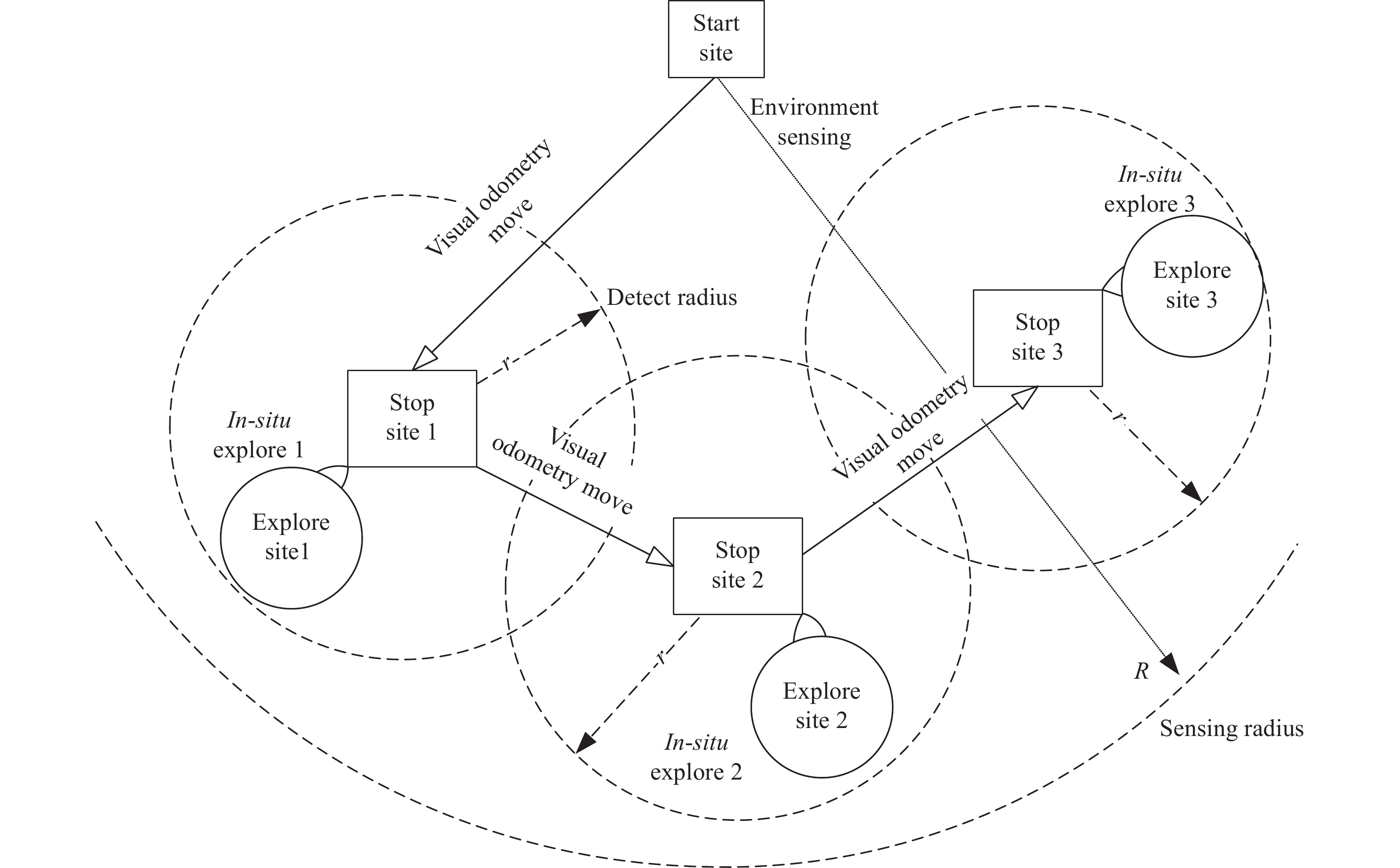
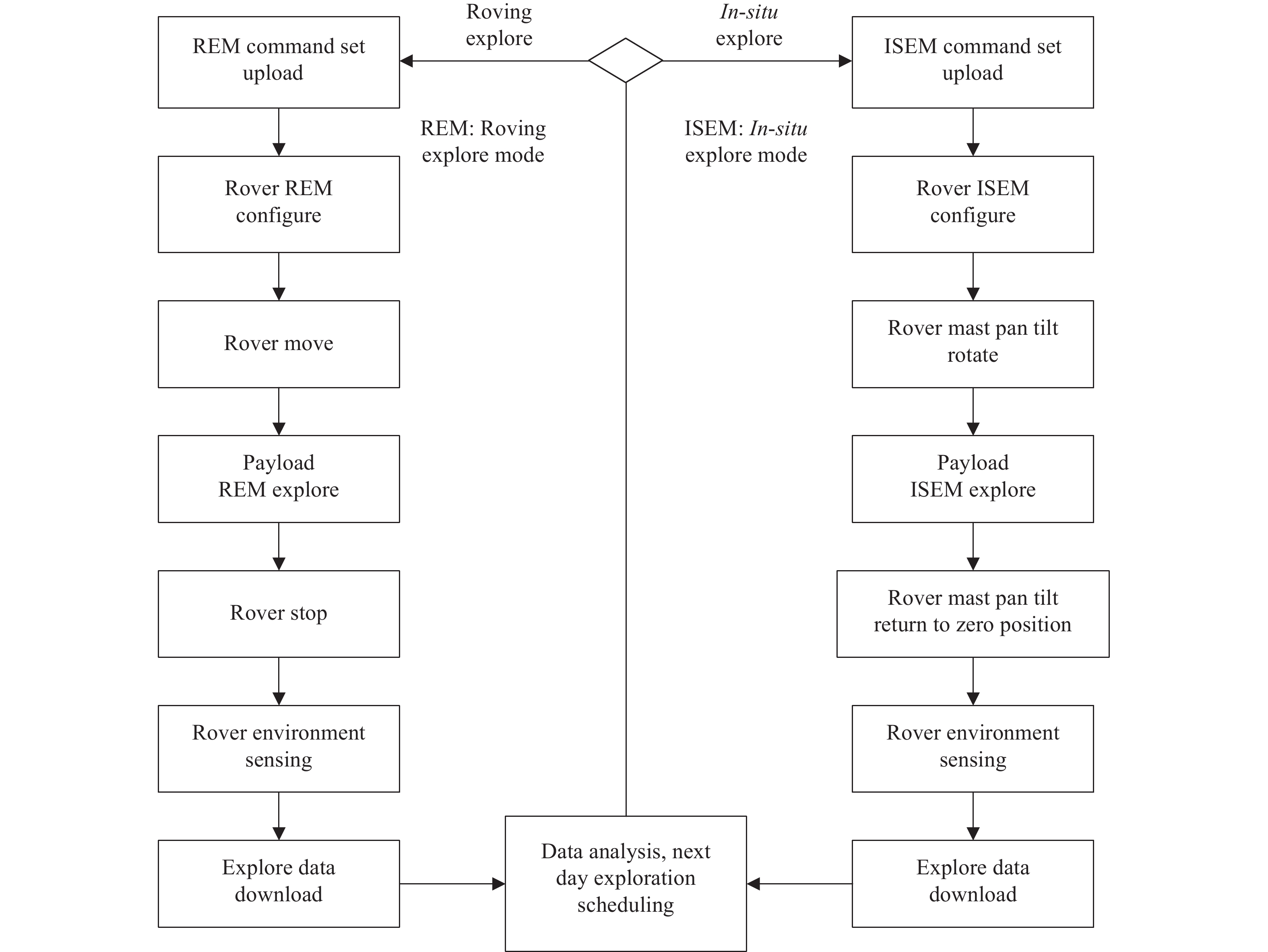
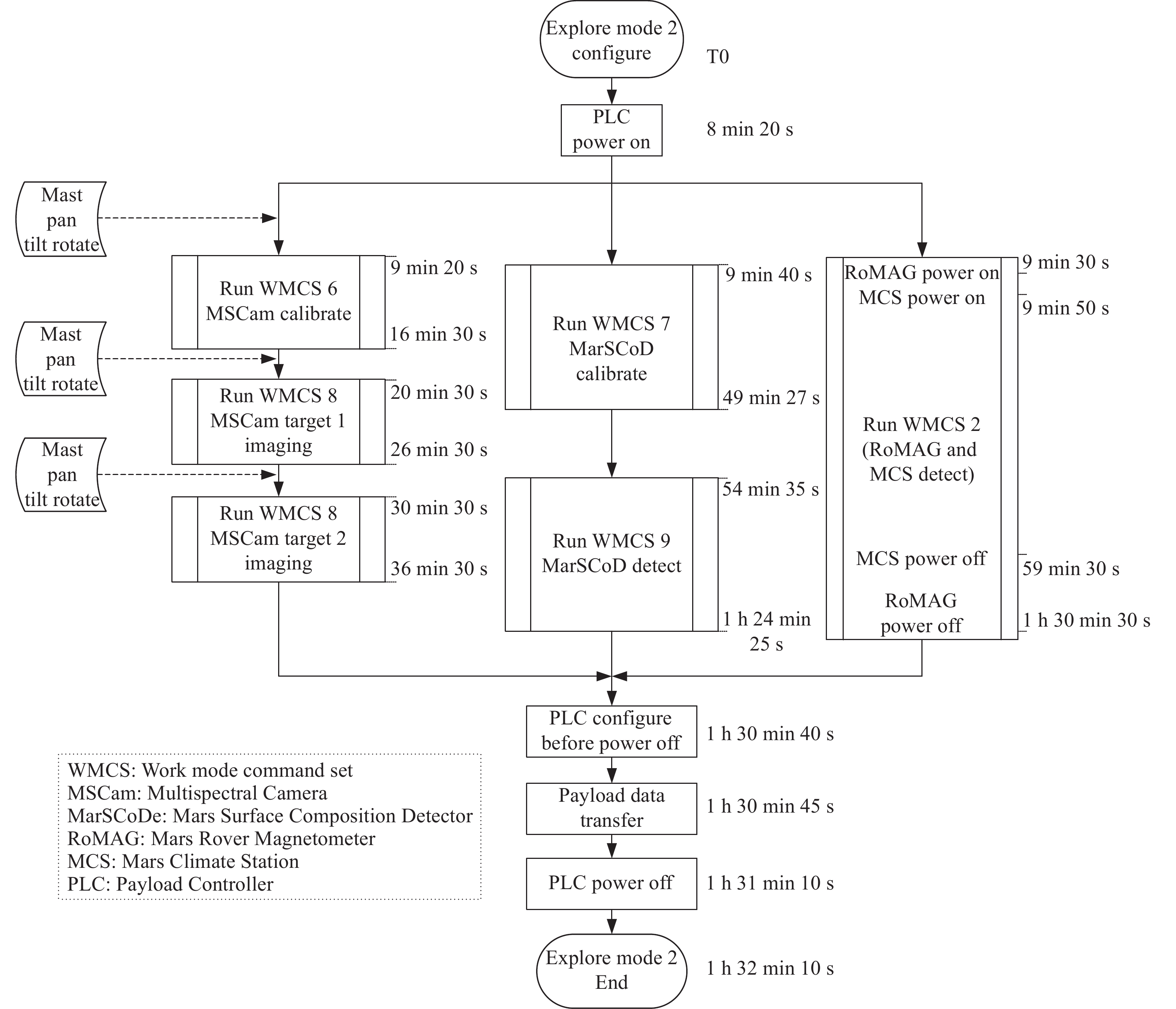
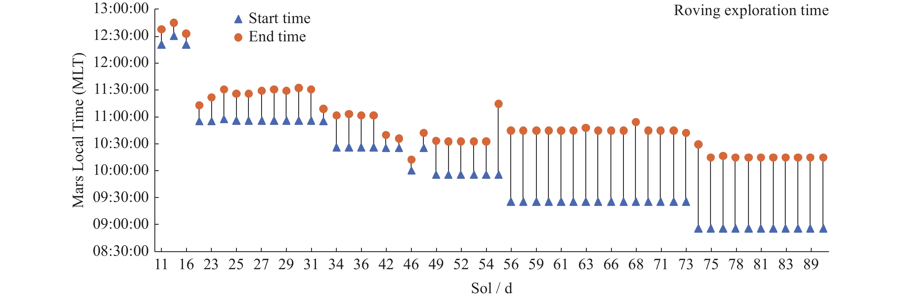
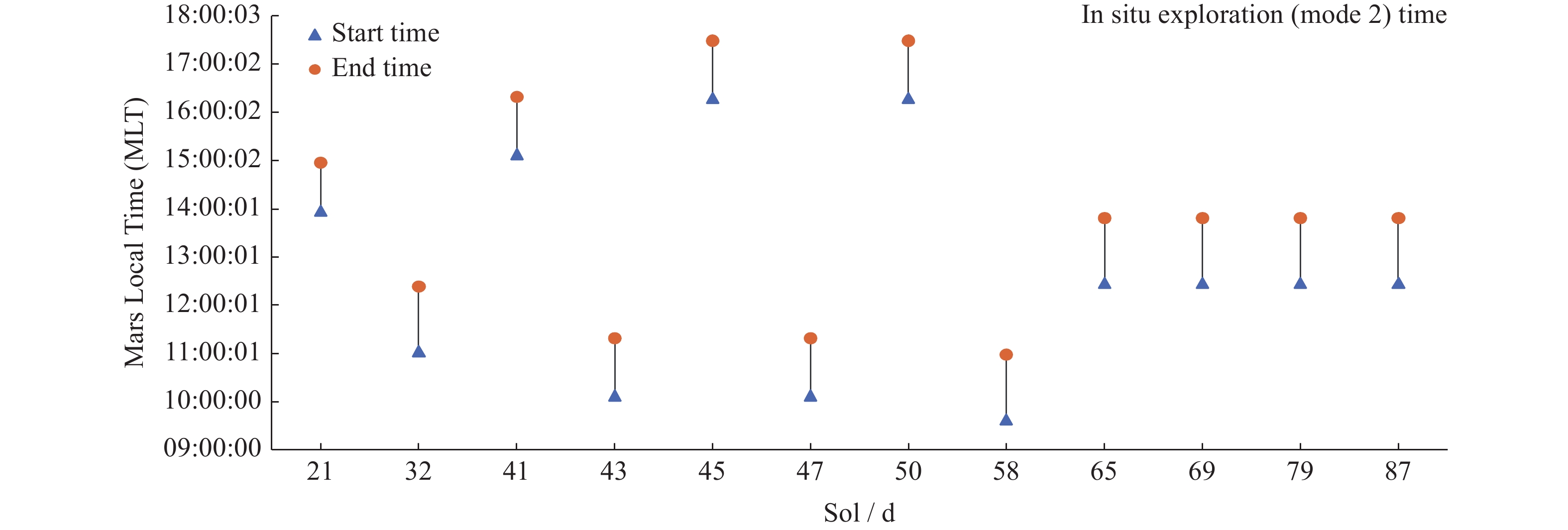
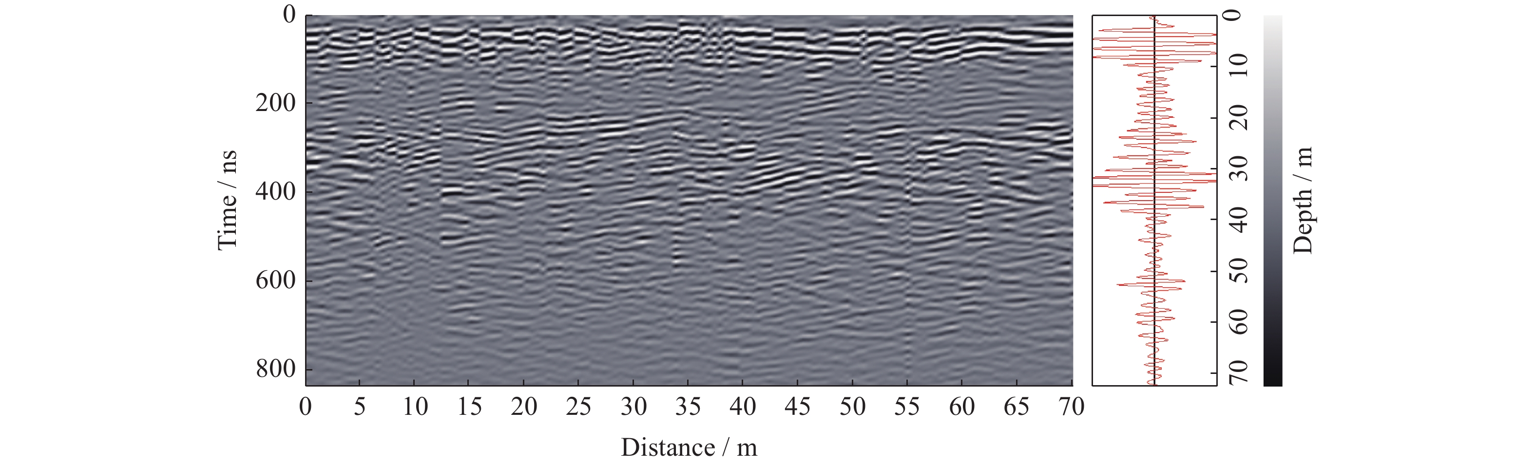
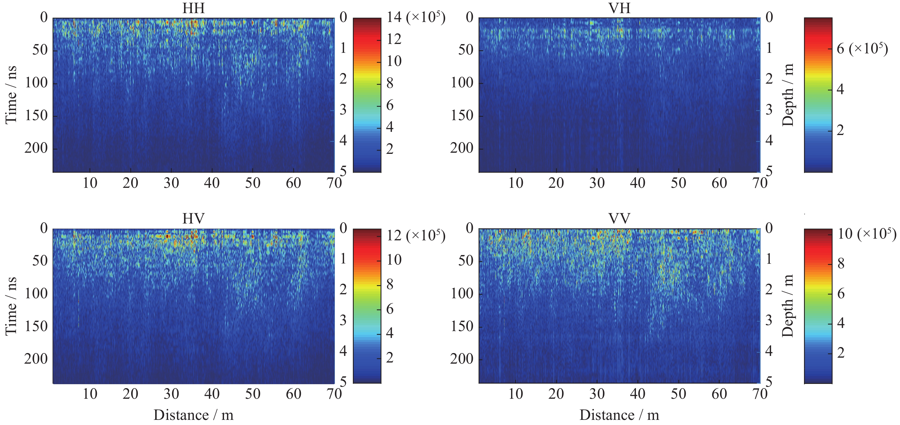
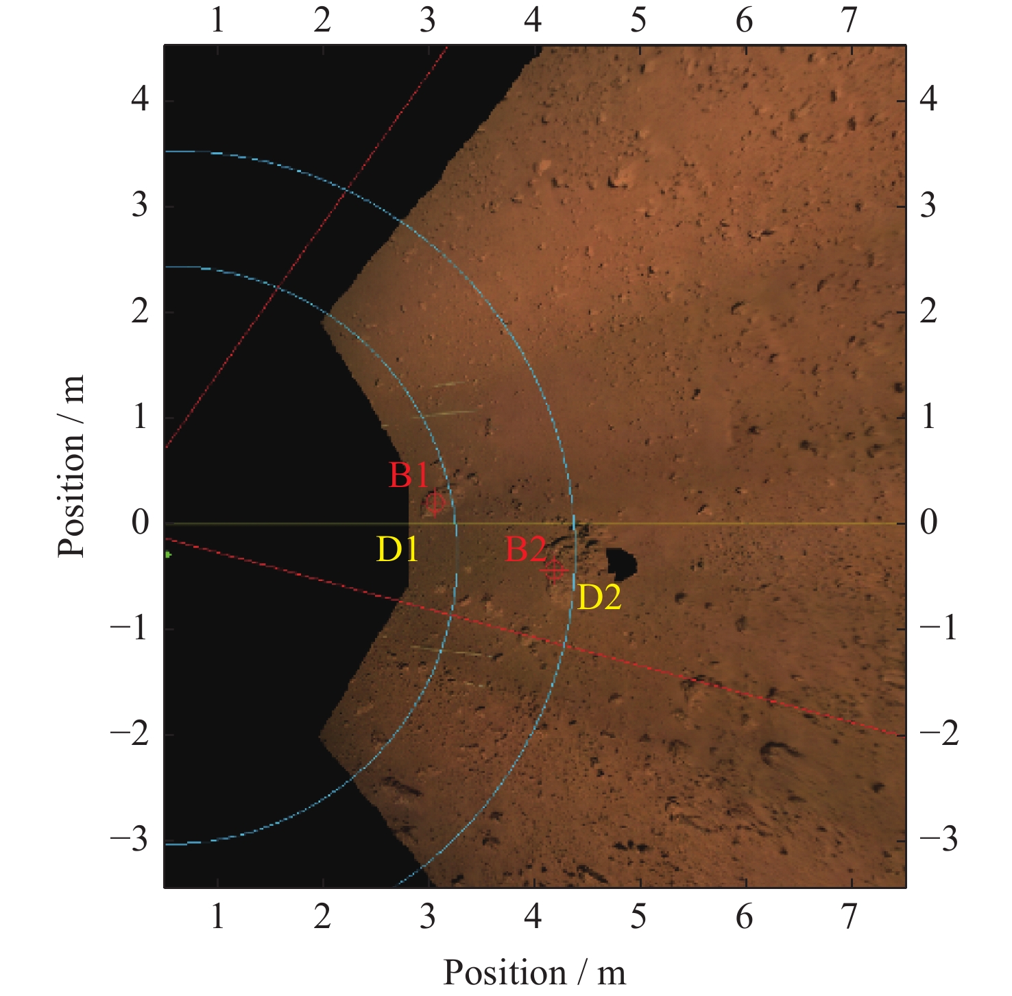
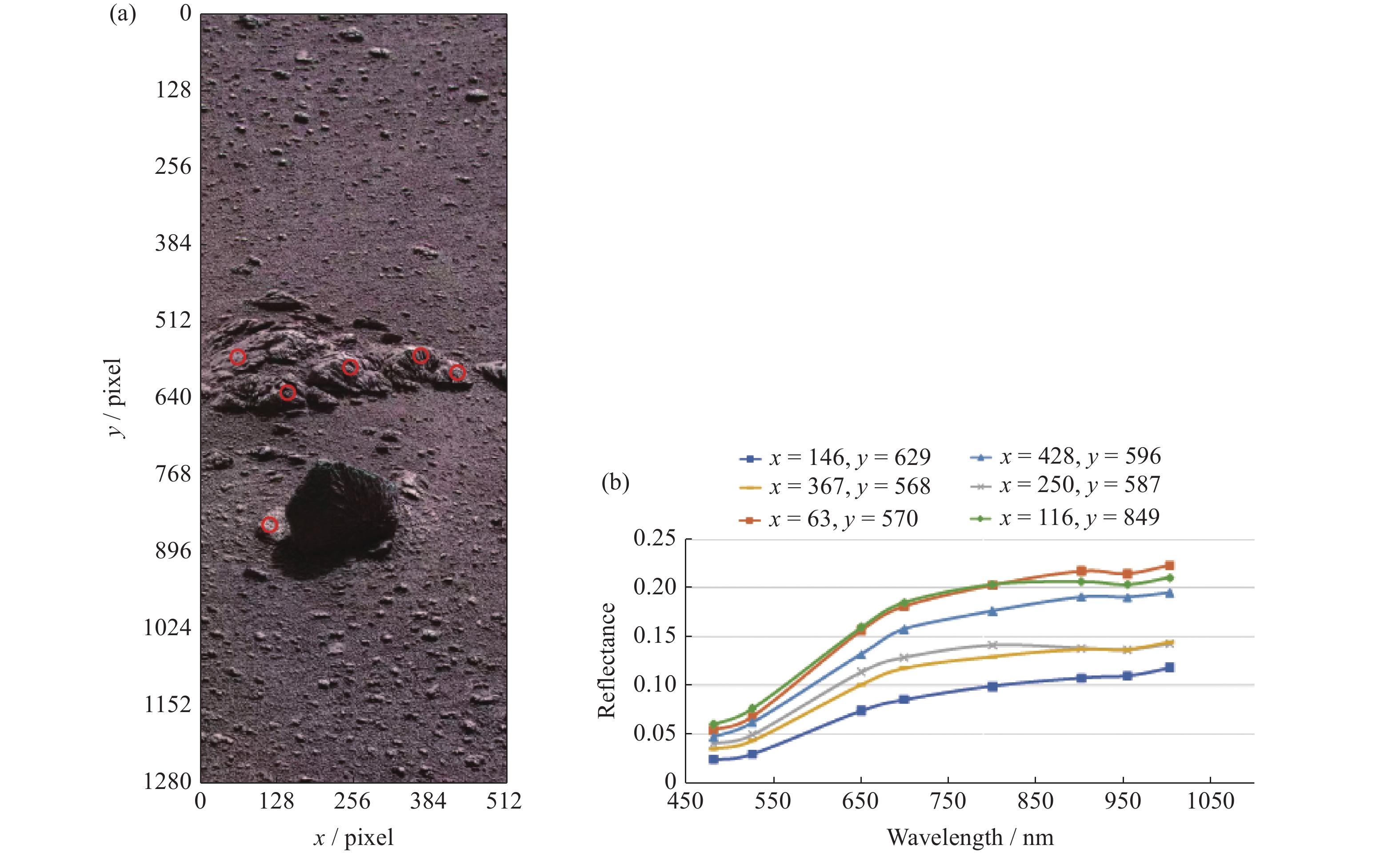
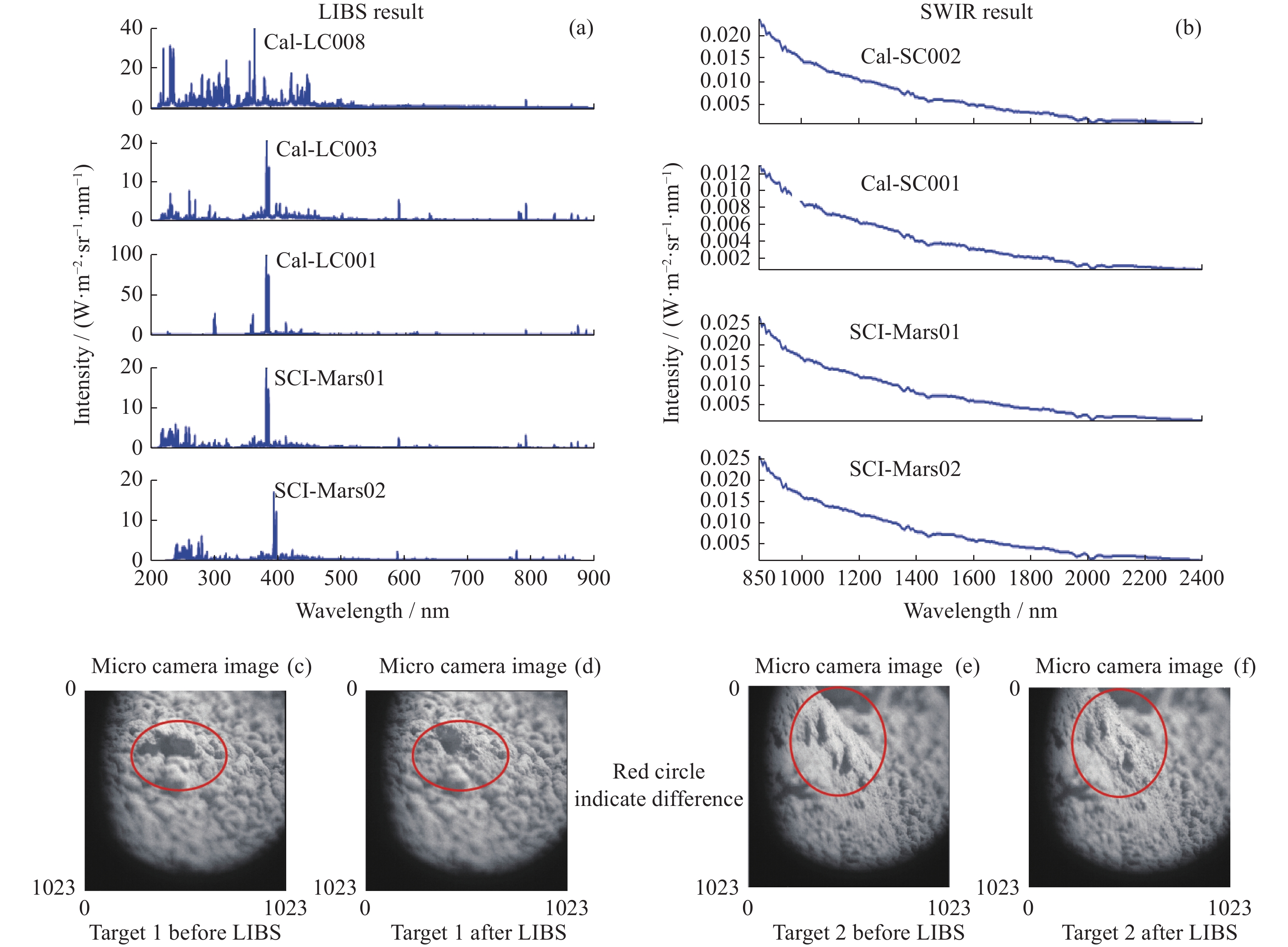
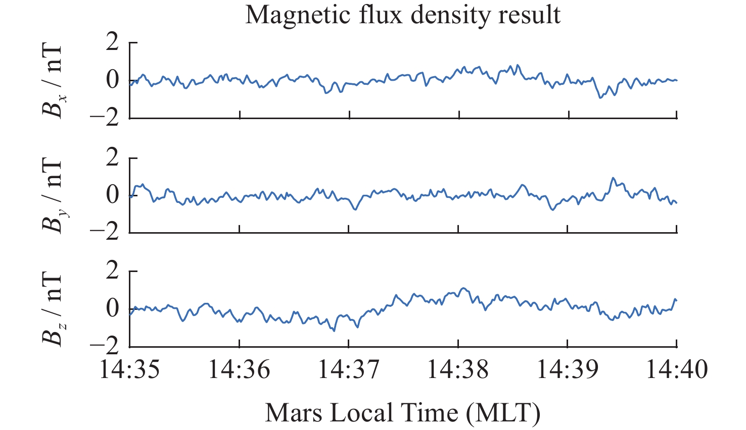
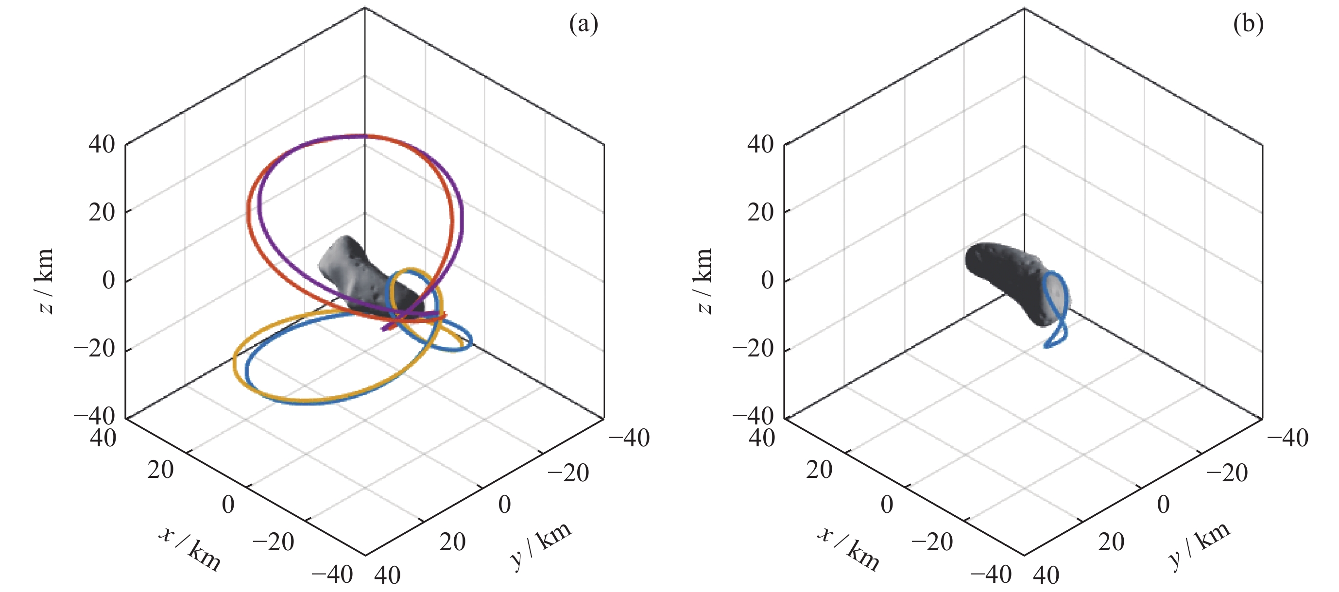
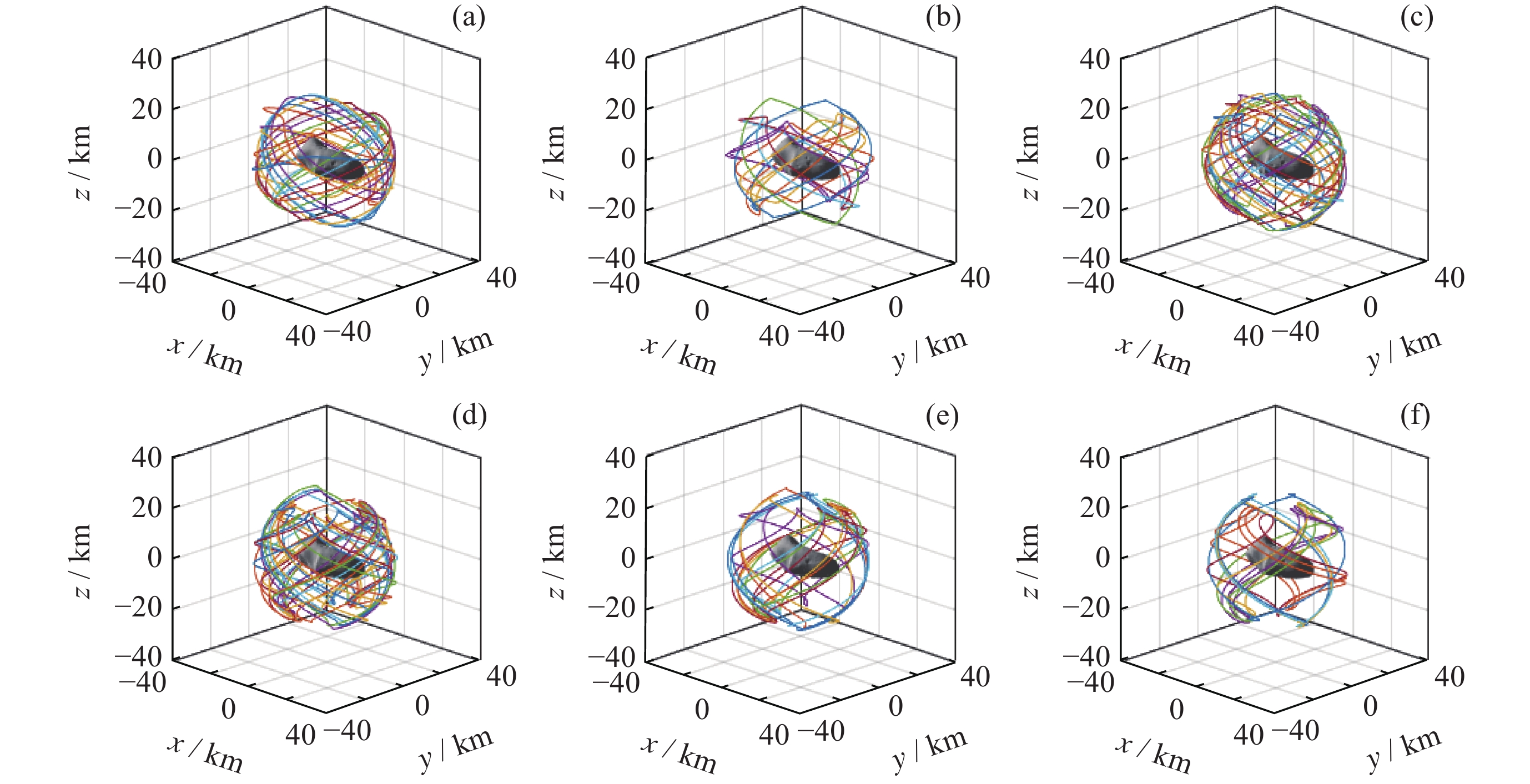
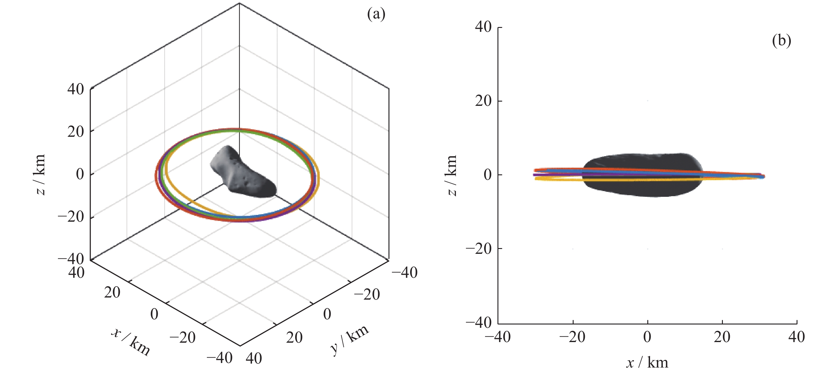
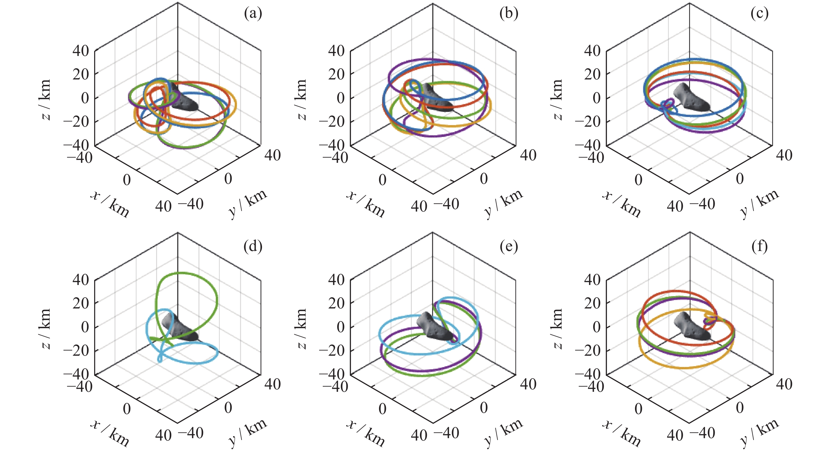
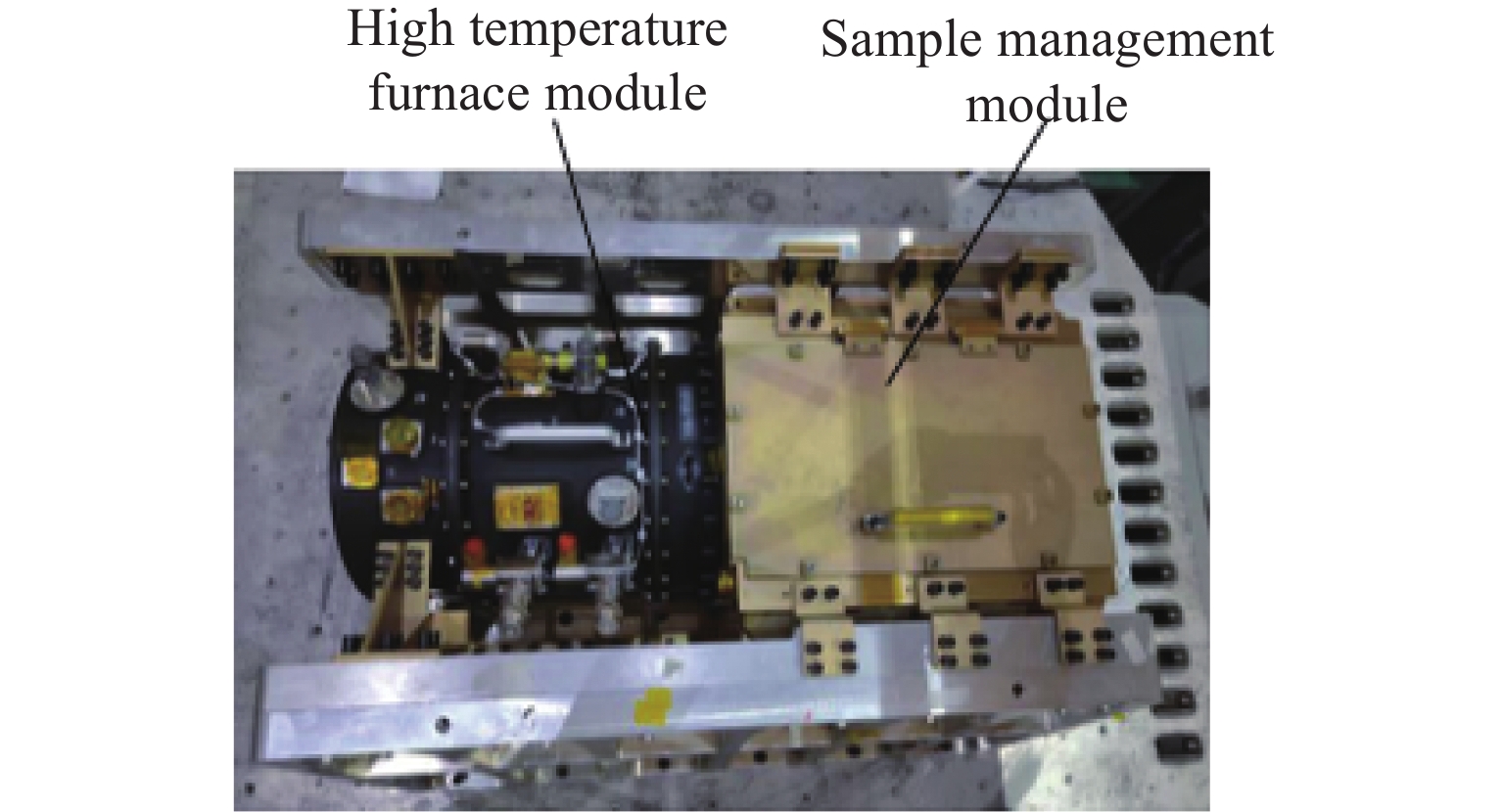
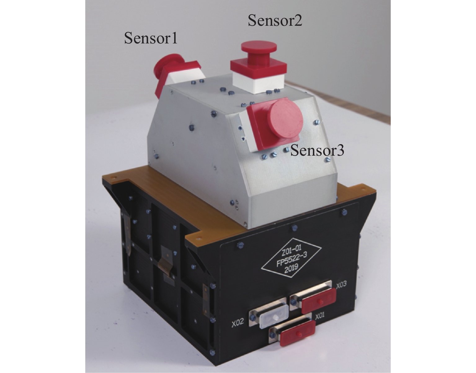
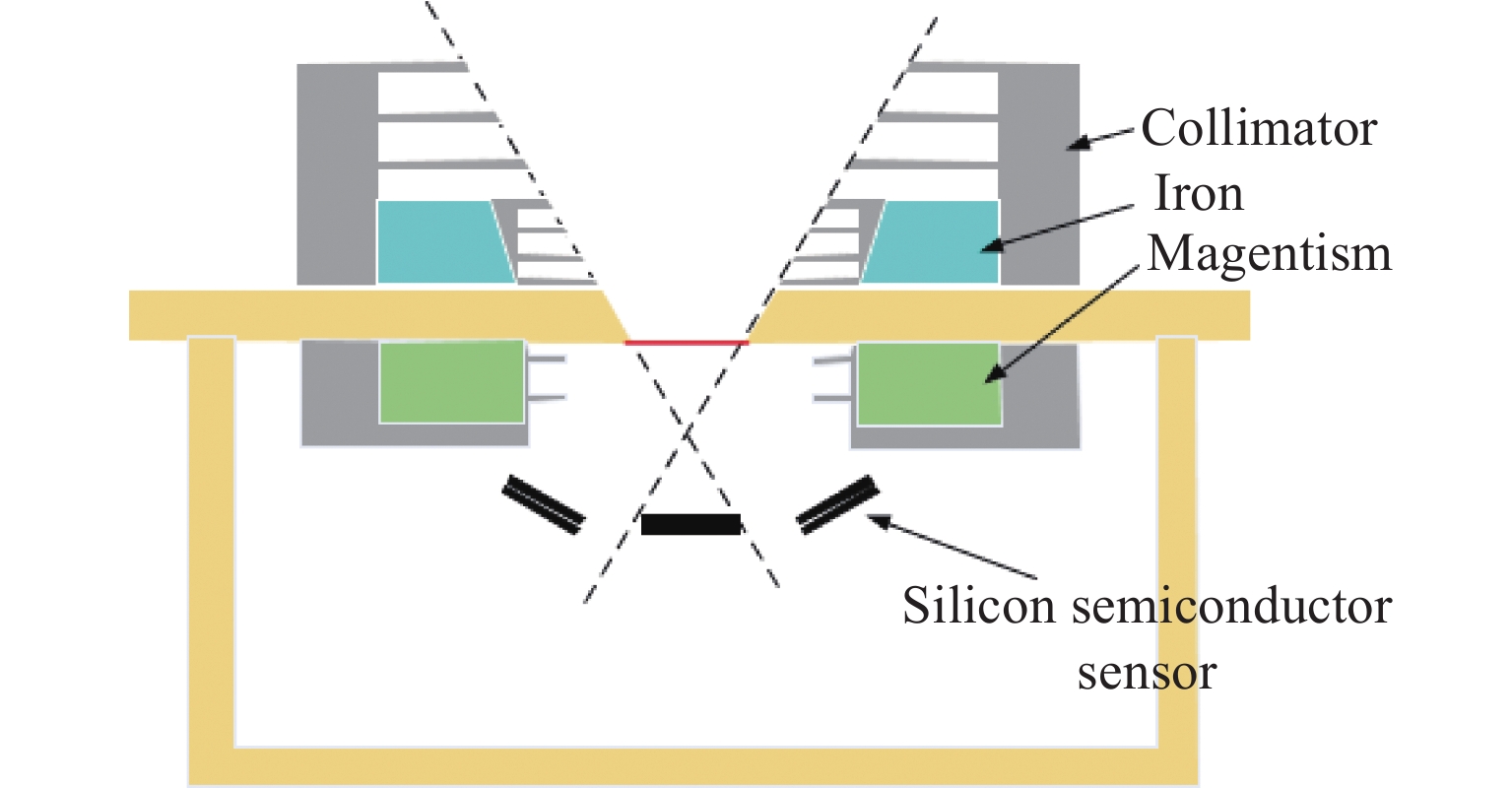
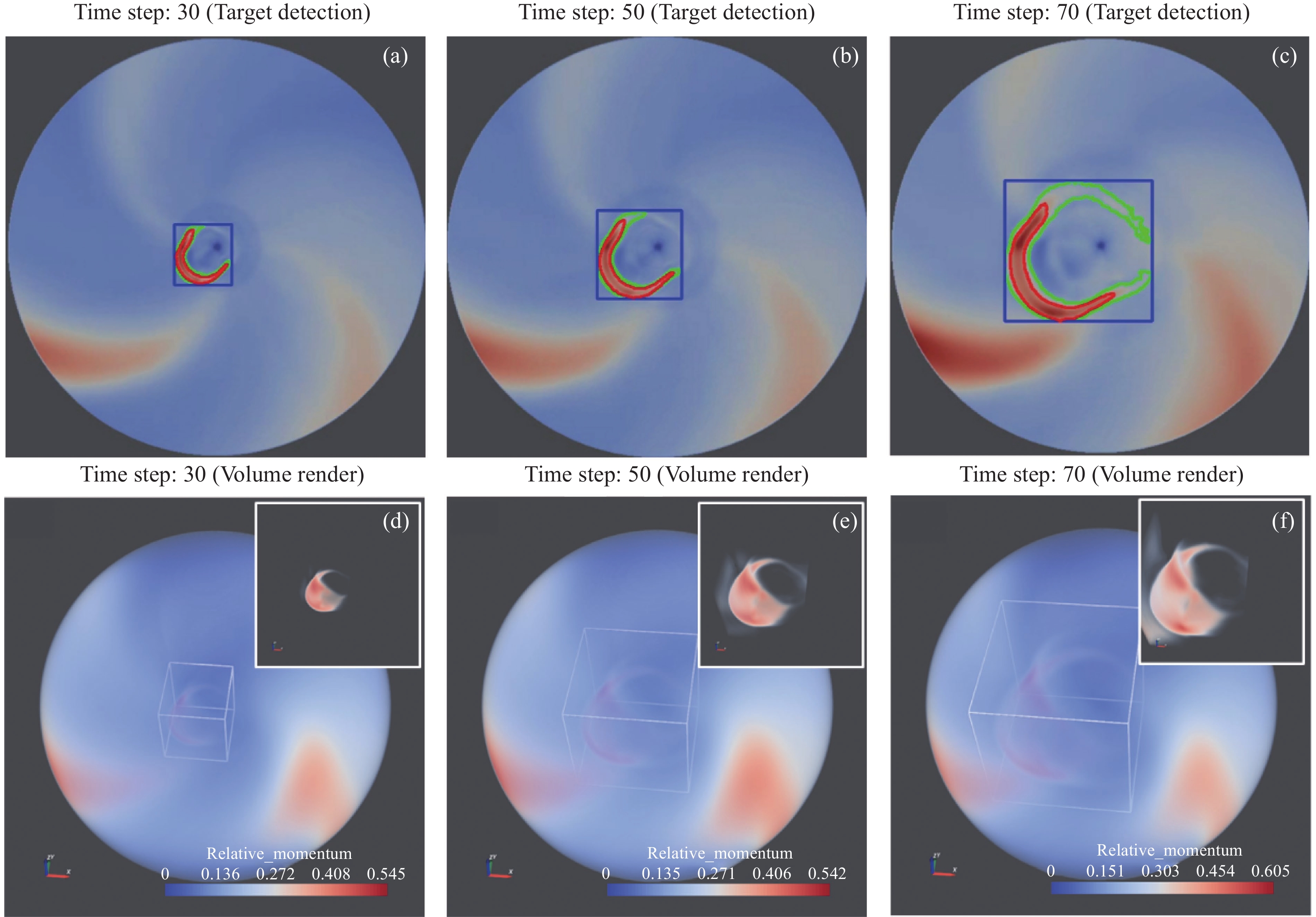
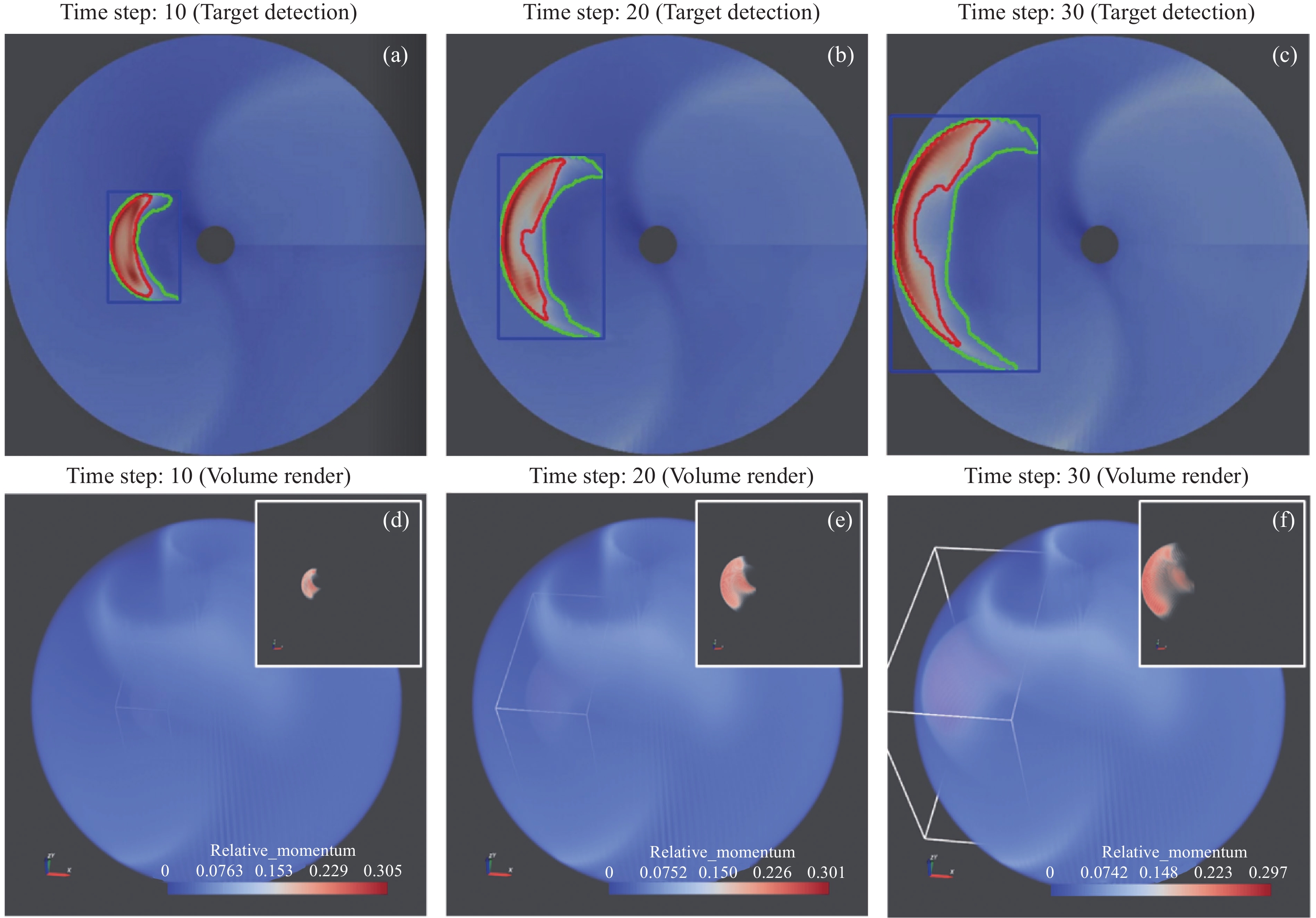
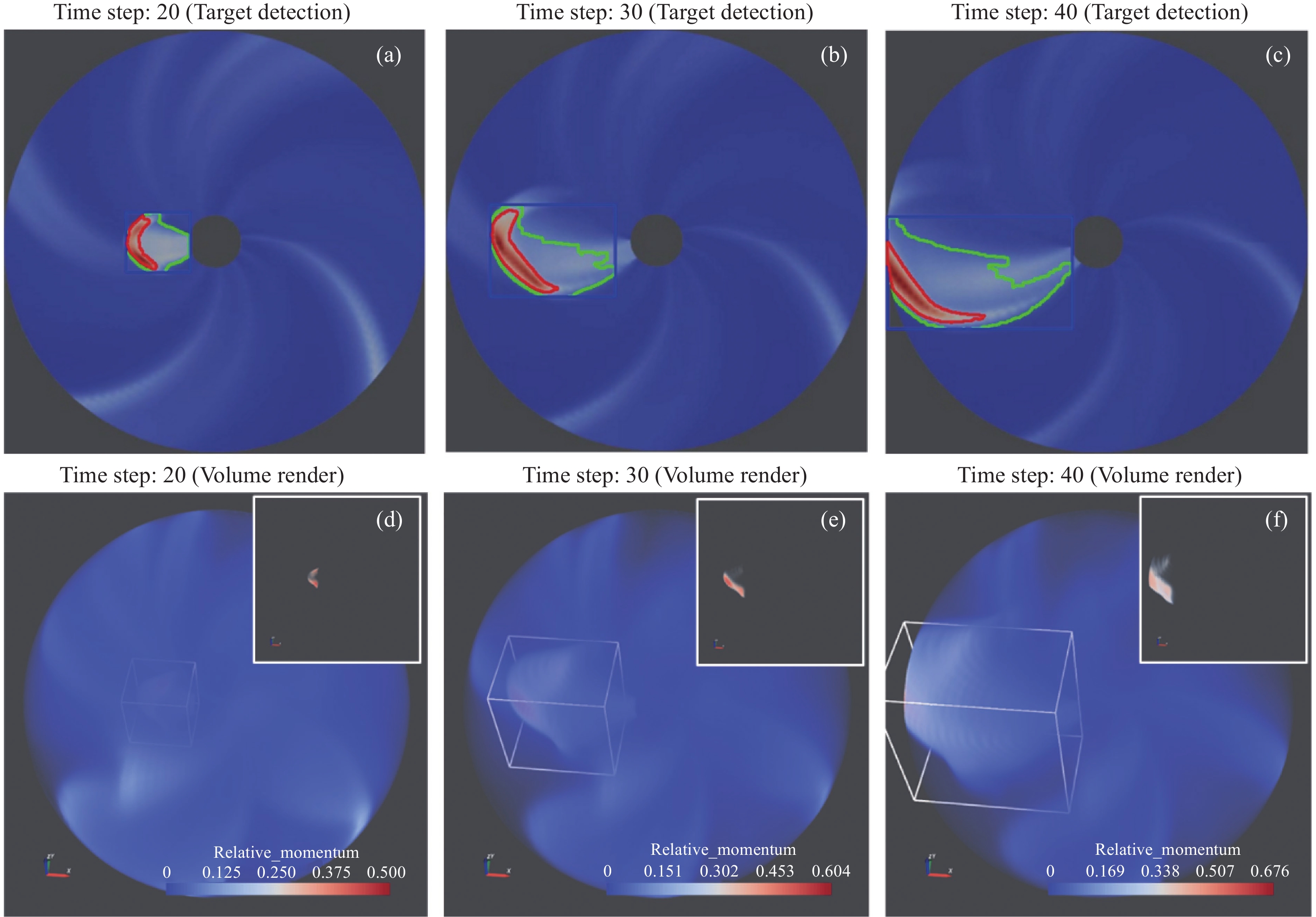
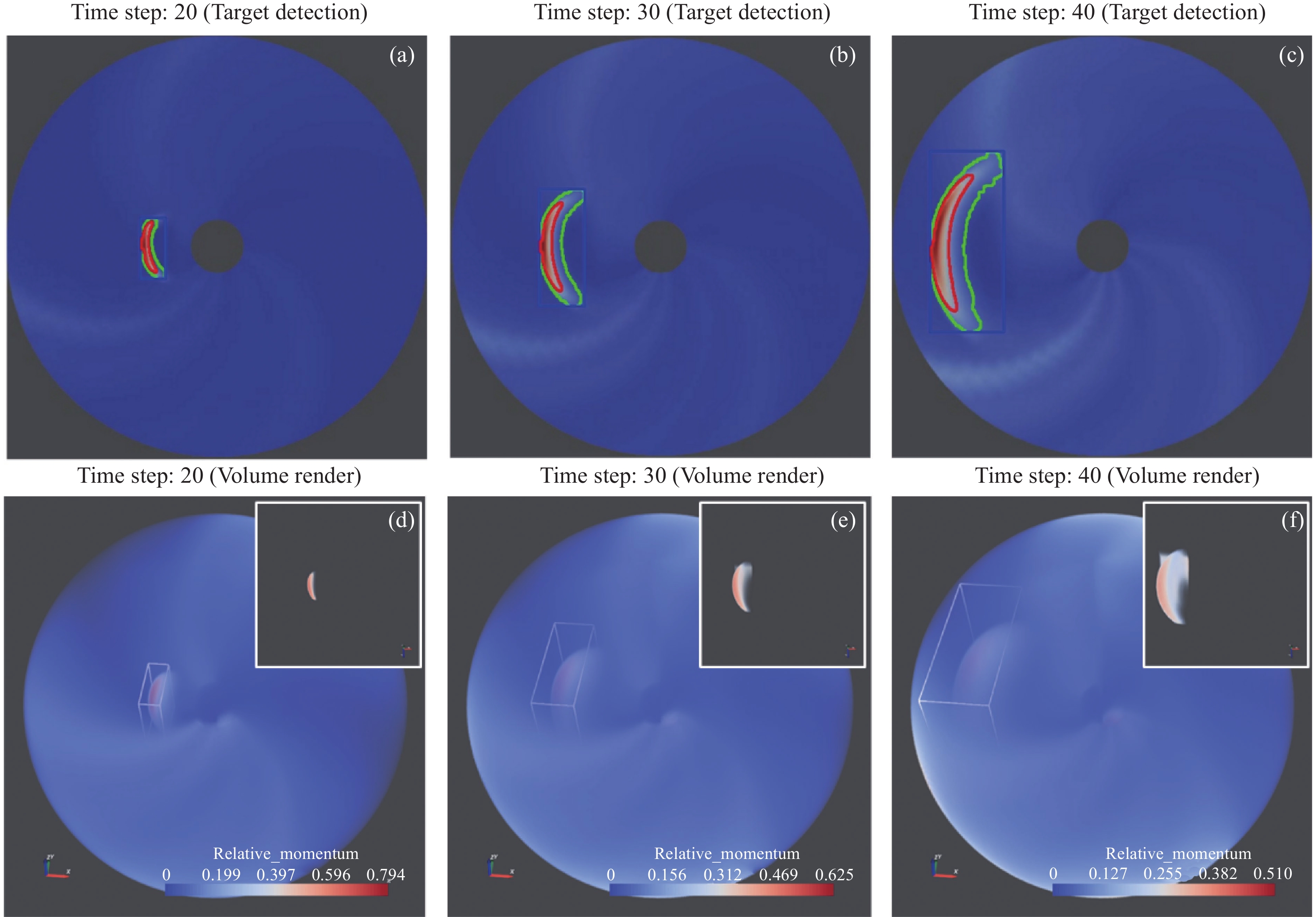
The Zhurong Mars rover conducts high resolution in situ surveys in a critical area of Mars. The scientific payloads mounted on the rover include: Navigation and Terrain Camera (NaTeCam), Multispectral Camera (MSCam), Mars Rover Penetrating Radar (RoPeR), Mars Surface Composition Detector (MarSCoDe), Mars Rover Magnetometer (RoMAG) and Mars Climate Station (MCS). Their scientific exploration tasks include studying topography and geological structure of the Mars roving area; surveying the soil structure (profile) of the Mars roving area and searching for water ice; surveying elements, minerals, and rock types of the Mars roving area; and surveying the atmosphere physical characteristics and the surface environment of the Mars roving area. To obtain as much exploration data as possible with limitations on low communication capability and insufficient energy, it is necessary to improve scientific exploration efficiency of the Zhurong Mars rover. There are two major operating conditions for the payloads, conducting roving exploration when the rover moves and in-situ exploration when the rover stops. Several high-efficiency payload exploration modes are developed for those two conditions. When designing the exploration modes, some aspects need to be considered. The first aspect is myriad of constraints, including rover resources and safety, the Martian environment, telecommunication, and the limitations of the software, hardware, and processes involved. The second, the rover is a shared resource: a variety of science and engineering activities must divide the available energy, time, and transmitted data volume, and must coordinate the use of the rover’s mast and mobility systems. The third point is that each payload has multiple operating modes that must be optimized and combined. The exploration modes, working with autonomous control based on work mode command set, solved the problem of multiple payloads performing collaborative scientific exploration under resource shortage conditions. The Zhurong Mars rover has successfully completed the scheduled exploration mission. All scientific exploration modes have been verified. The results demonstrate that the exploration modes are suitable and effective, and can meet the requirements for conducting safe, autonomous, and efficient scientific exploration.
Global Search Strategy for Periodic Orbit near an Irregular Asteroid
ZHANG Shidong, LI Mingtao
2023, 43(3): 507-520. doi: 10.11728/cjss2023.03.220106002
Abstract:
Natural periodic orbits around irregular asteroids can help us better understand the dynamics of asteroids. The search process of periodic orbit requires frequent orbit recursion, and most of the calculation time is consumed in the calculation of gravitational acceleration near irregular asteroids. In order to improve the efficiency of acceleration calculation, a new fast estimation method for gravitational acceleration of irregular asteroids is proposed. On this basis, the initial guess of periodic orbits is obtained by random rough search in parameter space. Finally, genetic algorithm is used to find the initial value of periodic orbit. By searching the periodic orbits of irregular asteroid 433 Eros, the periodic orbits of different shapes near the asteroid are classified, and the distribution of periodic orbits near the asteroid is analyzed.
Recent Progress and Development Trend of Solid Combustion Research for Manned Space Exploration
WANG Shuangfeng, WU Chuanjia
2023, 43(3): 531-548. doi: 10.11728/cjss2023.03.2022-0049
Abstract:
The understanding of solid material flammability in the specific use environment is of practical importance for manned spacecraft fire safety, and the relevant fire safety concerns in spacecraft have served as one of the primary motivations for microgravity combustion research. In recent years, the various space powers have paid continuous attention to the burning characteristics of solid materials and the corresponding application to spacecraft safety. It seems that a renewed interest in such a research field is arising, while distinct features and development trends could be identified. This paper reviews the research progress and latest results on microgravity solid combustion in recent ten years. Overall development trends of the field and future directions of research work are also discussed, hoping to provide useful reference for further research.
Vacuum Chamber Design and Analysis of the Space Station High Temperature Material Science Experimental System
CUI Xiaojie, SUN Jinchuan, KANG Changxi, DUAN Fuwei, ZHANG Fuhua, MA Yankun
2023, 43(3): 549-557. doi: 10.11728/cjss2023.03.220321031
Abstract:
The Chinese Space Station High Temperature Material Science Experiment System is capable of conducting microgravity high temperature heating experiments of multiple materials types in orbit. The vacuum chamber, one of the key components, is a pressure vessel that can be sealed. It is equipped with interfaces for the experiment inserts such as mechanical, vacuum, nitrogen, exhaust gas emission, power supply, control and cooling. In this paper, the structure design and analysis of the vacuum chamber is based on the technical indicators such as pressure-bearing range and leakage rate. The vacuum chamber adopts a sectional structure, which consists of a square vacuum chamber assembly, a sealed door assembly, a circular vacuum chamber assembly, a mounting bracket, etc. Seals are used at the connection positions. The strength, stiffness and random vibration response of the vacuum chamber structure were checked through pressure analysis, modal analysis, random response analysis and mechanical vibration test. The results verified the safety and reliability of the vacuum chamber design, which can meet the launch and in-orbit operational requirements.
Calibration of the Medium Energy Proton Detector of FY-3E
HAO Mengtan, ZHANG Shenyi, HOU Donghui, SHEN Guohong, ZHANG Huanxin, SU Bo, BAI Chaoping, SUN Ying, ZHOU Ping, JI Wentao
2023, 43(3): 558-566. doi: 10.11728/cjss2023.03.220329033
Abstract:
FY-3E is the first satellite among the FY-3 series that has observed protons with medium energy in multiple directions. The medium energy proton detector can measure the energy spectrum of protons with the energy range of 0.03~5 MeV in nine directions. In order to determine the actual performance of the medium energy proton detector, before the instrument delivered, the energy resolution, relative response efficiency curve, measurement consistency of probes in different directions, and anti-electron pollution ability of the medium energy proton detector were calibrated using the medium and high-energy electron accelerator of the National Space Science Center of the Chinese Academy of Sciences. This paper introduces the calibration site and contents of the instrument, and analyzes the calibration results. The results show that the energy resolution of the instrument is 6.50% @ 310 keV, the consistency deviation of each measurement is better than 1.51%, and the probability of electronic pollution counting in the instrument is less than 1%.The results provide an important reference for the analysis and processing of the data of the intermediate-energy proton detector in orbit.
Spectrum Sensing for Combined GEO and LEO Satellites Based on Bi-LSTM and Bayesian Likelihood Ratio Test
YANG Kai, HU Shengbo, ZHANG Xin
2023, 43(3): 567-575. doi: 10.11728/cjss2023.03.2022-0017
Abstract:
With LEO mega satellite constellations coming into operation, the available spectrum resources are more crowded. To improve spectrum utilization, the cognitive satellite communication network composed of GEO relay satellites and LEO satellites has become one of the important candidate technologies to solve the above problem. In this scenario, LEO satellites are permitted to access the authorized spectrum of the GEO satellites through spectrum sensing technology. To avoid interferences from secondary users, spectrum sensing, which is used to quickly determine the presence or absence of primary users, is the most critical step in the scenario of cognitive satellite communication. Since most current spectrum sensing algorithms are model-driven, they rely heavily on the predetermined statistical model for their detection performance, which makes it more difficult to be modeled and deployed in satellite communication scenarios with complex channel environments. In this paper, we first analyze the fluctuation of the Signal-to-Noise Ratio (SNR) at the LEO satellite’s receiving end with the satellite-to-ground link loss model. The results show that the SNR’s fluctuation reaches 14 dB during satellite transit. Secondly, in this complex channel environment, a spectrum sensing algorithm combining a Bidirectional Long Short-Term Memory (Bi-LSTM) network and a Bayesian likelihood ratio test is proposed. The algorithm can automatically learn hidden features from the primary user signals and make final decisions without requiring any prior knowledge of the primary user signals. Additionally, according to the Neyman-Pearson criterion, we design a threshold-based detection mechanism at the output of the Bi-LSTM network, which can conveniently control the false alarm probability. Finally, the simulation results show that even with an SNR of –14 dB, the proposed algorithm achieves an excellent detection performance of 83% and always outperforms convolutional neural networks, multilayer perceptrons, and model-driven energy detection algorithms.
An FPGA-implemented Method for Real-time Multi-dimensional Feature Extraction of Sequence Image Targets
FENG Shuichun, WANG Zhipeng, YANG Jianjun, ZHOU Hai, BIAN Chunjiang, MENG Xin
2023, 43(3): 576-585. doi: 10.11728/cjss2023.03.2022-0014
Abstract:
The prerequisite of target detection and tracking is to model and represent the target based on multi-dimensional features extracted from the target region. The traditional target feature extraction needs to connect the target region first and then must calculate the target feature, which has still room for improvement in real-time performance. An advantage of the new method based on the synchronous calculation of pixel-connected domain markers and target features is that the target features can be output when the target region is connected. This article proposes a method highlighting pixel-based marking of connection domains and synchronous computation of target features, which can output target features immediately after target areas are connected. By setting up a feature transfer mechanism, this method establishes a marker table, a marker mapping table and a feature attributes table while scanning images, and links the marker mapping table and the feature attributes table with the help of the marker table. When different areas are adjacent to one another, markers are consolidated while the features’ attributes are synchronously transferred and computed, ensuring real-time extraction of the target features. Regarding real-time and multiple-dimensional extraction of the features of multiple targets in high-resolution distant sensing images, the article proposes an implementation plan based on FPGA hardware design. According to the results of a number of simulation tests, the method featuring high-speed marking of connection domains over one iteration of split pixels and real-time computing of target features boasts the following outstanding characteristics: The time consumed by marking connection domains is only (L × W + 2n/m) × Tclk, close to the theoretical minimum (L × W) × Tclk; saving images in cyclical buffers only takes up few resources; parallel pipeline processing of marking and computation improves the detection and tracking efficiency; the test results of multiple target features are accurate and consequently can effectively support subsequent target tracing detections; and the method also has both theoretical and practical values.
Space Physics
A Time-varying Volume Data Transfer Function for Interplanetary Numerical Simulation Data
ZHU Yan, ZHONG Dingkun
2023, 43(3): 423-433. doi: 10.11728/cjss2023.03.2022-0011
Abstract:
Understanding the interplanetary propagation of solar storms is the foundation of space environmental forecasting and services. The visualization of numerical model simulation data is an important method to analyze the propagation dynamics process and verify the validity of the model. In order to facilitate the visualization analysis of the numerical model simulation data with increasing simulation scale, a Transfer Function for Time-varying Volume data rendering (TFTV) based on the characteristics of time domain and frequency domain is proposed. The algorithm is designed to extract images including motion regions based on the K-Nearest Neighbor (KNN) background subtraction method, and then the three-dimensional subset of the moving region can be extracted according to the mapping relationship between the image and the volume data to achieve the reduction of large-scale grid volume data. Then the Frequency Tuned (FT) salient region detection algorithm is used to detect Coronal Mass Ejection (CME) in motion area images, and according to the CME detection results, a color inverse mapping algorithm is designed to find the boundary threshold between the CME and interplanetary space background. Finally, the transfer function design in volume visualization is adaptively adjusted based on the threshold to realize the fast 3D visualization of CME in the motion region at each time step. The experimental results show that TFTV transfer function algorithm can adapt to the numerical model simulation data in static and dynamic backgrounds. Compared with the linear transfer function, the occlusion of the line in sight direction is effectively avoided, the change of relative momentum is intuitively and automatically displayed, and the evolution process of CME in interplanetary space is traced. The extraction of local regions reduces data redundancy, and the process of adaptively adjusting the transfer function by automatically analyzing the data with the help of algorithms avoids the inefficiency of manual adjustment.
A Comparative Study between the Ionospheric f0F2 from Nighttime OI 135.6 nm Emission and Ionosonde Observations
XUE Shixiang, JIANG Chunhua, MA Zhengzheng, XU Bin, DING Guangxing, YANG Guobin, ZHANG Yuannong, ZHAO Zhengyu
2023, 43(3): 456-465. doi: 10.11728/cjss2023.03.2022-0018
Abstract:
The ionosphere is the part of the upper atmosphere which is ionized by solar radiation. There are a variety of ground-based and space-based remote sensing and in situ instruments to study the ionosphere. Recently, an effective method, called passive optical remote sensing technique, is widely used to study the ionosphere. It utilizes natural airglow (atoms and molecules frequently emit light to shed their excess energy) in the ionosphere. In the electromagnetic spectrum, the far ultraviolet light emissions are prominent in the ionosphere and could be used to monitor the ionosphere. During the nighttime, the 135.6 nm spectral line is excited by the radiation recombination process of F region O+ and e and the mutual neutralization process of O+ and O in the ionosphere. There is a strong correlation between the intensity of the spectral line and the maximum electronic density of ionospheric F2 layer (NmF2). Based on the physical model in which the OI 135.6 nm emission is proportional to the square of NmF2, the retrieval algorithm is established for different longitude, latitude, local time, season and solar activity. In this paper, the critical frequency of ionospheric F2 region (f0F2) is retrieved from 135.6 nm emission observed by the Special Sensor Ultraviolet Spectrographic Imager (SSUSI) instrument on board the Defense Meteorological Satellite Program (DMSP), and then the estimated results are compared with the detection results of ground-based ionosonde. As the results show, during the high-solar activity year (2013), the data with relative error less than or equal to 20% accounted for 93.0%, and the average relative error is about 7.08%. During the low-solar activity years (2017), the data with relative error less than or equal to 20% accounted for 80.8%, and the average relative error is about 12.64%. Finally, we analyze the difference of retrieval accuracy of the algorithm during the high and low solar activity years.
Responses of the Middle and Upper Atmospheric Wind to Geomagnetic Activities
LIU Jinfang, JIANG Guoying, XU Jiyao, ZHU Yajun
2023, 43(3): 466-474. doi: 10.11728/cjss2023.03.2022-0016
Abstract:
Responses of the middle and upper atmospheric (80~100 km height) wind to geomagnetic activities have been investigated using neutral wind data from 2012 to 2018 years, which were observed by Mohe, Beijing and Wuhan Meteor radars. Daily averaged wind data for geomagnetic quiet condition ($ Kp\le 2 $) and geomagnetic disturb condition ($ Kp\ge 4 $) were chosen for comparison, and the variation characteristics of wind during geomagnetic disturbances were obtained. The observations show that the influence of geomagnetic activity on zonal wind varied with seasons and latitudes. For zonal wind, the effect of geomagnetic activity at higher latitudes tended to be more westerly wind in the upper mesosphere and more easterly wind in the lower thermosphere; while for the lower latitudes, it tended to be more easterly wind. In spring, the three stations had similar tendencies, and had no latitude differences. But the easterly wind in the middle atmosphere became stronger with the decrease of latitude in summer/winter. The effect of geomagnetic activities on the meridional wind had seasonal differences. The influence of geomagnetic activities in spring and winter was stronger than that in summer and autumn. According to the calculation results, the influence on zonal wind can be up to about 9 m·s–1, and on meridional wind can be up to about 5 m·s–1. The impact of geomagnetic activities on MLT wind can penetrate down to about 80 km.
Planetary Science
Evaluation of Orbit Determination Accuracy in Interplanetary Transfer Section of Mars Probe
DUAN Jianfeng, ZHANG Yu, KONG Jing, CHEN Ming, LI Cuilan
2023, 43(3): 499-506. doi: 10.11728/cjss2023.03.2022-0008
Abstract:
Tianwen-1 is the first Chinese probe to realize interplanetary flight between Earth and Mars. During the 202-day long interplanetary transfer flight, it experienced four midway corrections and one deep space maneuver control. On 10 February 2021, it successfully applied braking near Mars and was captured by Mars. This paper, the dynamic model during interplanetary transfer is analyzed, and the principle of celestial center conversion during transfer flight is formulated. It is necessary to replace the celestial center with the Sun after leaving the Earth’s influence sphere. According to the analysis results, DE436 ephemeris is determined to be used, because it has the least impact on orbit determination. Based on the characteristics of the interplanetary transfer flight of the probe, this paper proposes an accuracy evaluation method based on a daily iterative orbit determination strategy. Based on the analysis of measured data, the effectiveness of this method has been verified. During the interplanetary transfer of the Mars probe, the orbit determination position error is better than 2 km, and the velocity error is better than mm·s–1 (1σ).
Optical Observations and Its Application on Orbit Determination for 2016HO3 Exploration
HUANG Hao, LIU Shanhong, CAO Jianfeng, LI Xie, GAO Jian
2023, 43(3): 521-530. doi: 10.11728/cjss2023.03.2022-0026
Abstract:
Since an upcoming Chinese asteroid mission will target a near Earth asteroid Kamo`oalewa (2016HO3) and a main-belt comets 311P/PANSTARRS, a full simulation analysis has been made on the spacecraft optical navigation based on three types of optical observations collected by on-board cameras. The observations include the elevation and azimuth angle relative to the camera body coordinate system, the right ascension and declination in the celestial reference system, the angle between asteroid and the planets relative to the spacecraft. The dynamical model of the asteroid exploration mission was firstly built and then the celestial bodies could be observed during the mission for the third model was selected, which helped to determine the observation scheme and the pointing direction of the camera. Based on such setting, the observation was simulated which error is about one arcsecond and then the spacecraft orbit determination was calculated. The results indicated that when the observation time reaches 100 h, the 3D position accuracy of the spacecraft could reach 50 km, thus technically meeting the navigation requirement. However, the position and velocity in x and y direction are strongly autocorrelated, which means that the spacecraft position in xy plane cannot be easily constrained using only these optical observations. Meanwhile, the results also shown that the orbit determination accuracy based on single observation type data is 3~4 orders of magnitude lower than that of joint observations. The third-type observations make a much more significant contribution with respect to another two kinds of observations which indicates that the precise position of the solar system bodies is helpful when constraining the position of a spacecraft for 2016HO3 exploration.